Location Innovation Lab
Campus Map | Map Apps | Print Maps | Students and Employees | About Us
The Location Innovation Lab manages the University of Oregon's campus geographic information systems (GIS) and mapping program and builds software applications. We work to support a smarter, safer, and more resilient university.
Working with departments across UO, we maintain a home-grown spatial database of 30,000+ rooms and 375 buildings across multiple campuses. We leverage this database to engineer custom applications that are used daily by students, employees, and the campus community.
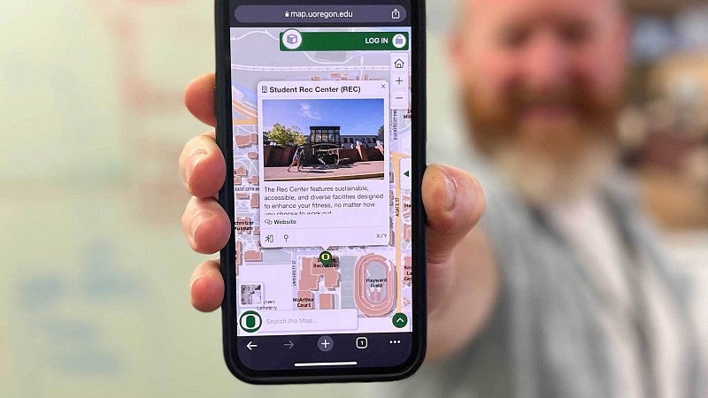
Map Apps
We work with partners across the UO to build apps that are layered on the campus map. Map apps display resources, tools, campus history, and points of interest. Some are visible to the public while others are restricted to students or employees
Public map apps can be used to locate pollinator habitats, find parking, and identify accessible routes through campus. The full list is available on the Campus Map.
Popular Public Map Apps
All-Gender Restrooms
Identifies more than 100 locations on campus. Restrooms are available for families with small children, people who have attendants, and our transgender and non-binary students, faculty members, staff, and community members.
Bee Campus
Features areas with pollinator nesting sites or have been landscaped to provide habitats for native pollinators. Bee Campus was developed with the Student Sustainability Center.
Indigenous UO
Highlights key points related to Native American and Indigenous history on the Eugene campus. Indigenous UO was created with students from the Native American and Indigenous Studies Academic Residential Community.
Parking
Shows parking zones, pay stations, and types of parking on campus. Users can also find electric vehicle charging stations using this map app.
Safety at Night
Provides an opportunity for everyone to help make campus safer. Anyone in the UO community can drop pins with brief descriptions on this interactive map to share night safety issues.
Transportation
Displays ways to get to, around, and from campus without using a personal car. Users can toggle on information about public transportation, bike parking, bikeshare hubs, and rideshare pick-up locations.
Featured Map App
Accessibility
This map highlights accessible routes, parking, and elevator locations across campus and was created in collaboration with Campus Planning, Design, and Construction and the Accessible Education Center.
User Tip:
UO Students and employees can log in and favorite this app to make it quick to find.
My Maps
Want to show someone where to meet for coffee, where to park, or where your office is located?
Using the campus map, you can create personalized, shareable maps. UO students and employees who login prior to making maps, will have them stored in the My Maps app.
To get started, go to the Campus Map and drop a pin.
- Click or tap anywhere on the map and select the pin icon.
- Add the text you’d like to appear.
- Repeat the steps to add additional locations.
- When you’re finished, click I’m Done to create a map url.
Tips
- Map pins can be added outside and indoors.
- The Pop-Up Title for the first pin will become the title of the map.
- Edit the text associated with each pin by selecting the pencil icon.
- A QR code is available to download when you create or edit a map.
LIL By the Numbers
We believe in the power of a pin drop.
UOregon Mobile
As the official app of the University of Oregon, UOregon Mobile provides quick links to resources including UO Alerts, the Campus Map, Transportation Services, and campus safety information.
Learn more about UOregon Mobile or download the app for your Android or Apple device.
About Us
The UO’s campus map is the proving grounds for some of our most cutting-edge, smart-city software innovations. The technologies behind the campus map are born of over two decades of research and innovation projects, instructing and working with students, or through industry partnerships.
Our location engine is at the heart of maintaining geospatial data and accurately mapping the buildings, infrastructure, and rooms of the UO. We’re known for developing some of the most sophisticated and innovative ‘indoor’ mapping features. The same technology that drives the Campus Map is used by hundreds of people to power apps that have routed more than 95,000 calls for service. While the public facing maps are important, our most innovative work is done behind the scenes.
Our software stack addresses a wide range of issues important to organizational resilience including:
- Field tools for facilities maintenance
- Asset management
- Student food insecurity
- Incident and large event management
- Situational awareness
IROCE
The Location Innovation Lab is also a program in the UO's Institute for Resilient Organizations, Communities, and Environments. By also operating within an institute, we can collaboratively innovate on projects with an applied research approach.
Meet The Team
Ken Kato
Director
he/him/his
Justin White
Senior Developer
he/him/his
Brook Eastman
GIS Manager
she/her/hers
Andreas Wenzel
Software Developer
he/him/his
Lillie Parker
GIS Analyst Programmer
she/her/hers
Amy Shadell
Innovation Program Coordinator
she/her/hers